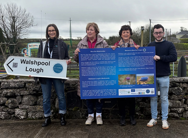
Great to welcome Kate from the Mayo County Council Water Office and LAWPRO to the village this morning, where she met with our Community Council and Belcarra Tidy Towns volunteers.
We were delighted to receive new signage for Walshpool Lake, officially designated as a Blue Dot Lake – the highest possible water quality status. A real source of pride for our community and a fantastic local amenity.
Work will continue over the coming weeks to improve accessibility and signage, ensuring more people can enjoy this special place responsibly and sustainably.
About Walshpool Lake
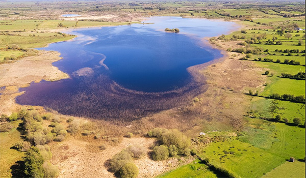
Walshpool Lough is Belcarra’s Blue Dot lake. It is a lowland lake situated a kilometre east of Belcarra village. It is a marl lake, a type of alkaline lake where the bed includes large amounts of marl, a soft light coloured substrate consisting of calcium carbonate deposits.
Walshpool is situated in an area of limestone geology with exposed limestone bedrock along its north-western corner. In this area the vegetation is species-rich semi-natural grassland and fen. Alkaline fen is a habitat of conservation importance which is listed in Annex I of the EU Habitats Directive.
Community Involvement

Walshpool Lough is a waterbody with a rich natural and cultural heritage. In order to facilitate access to the lake, Belcarra Tidy Towns collaborated with the LAWPRO and a local landowner to develop a pathway from the village to the lakeside. The local landowner, donated a section of their land and Belcarra Tidy Towns funded contracting works on the site with support from LAWPRO to open the final section of the pathway. The remainder of the walk is composed of existing quiet country roads and the beginning of Belcarra’s biodiversity friendly public greenways that you can also explore.
Belcarra Tidy Towns and Local Authorities Waters Programme (LAWPRO) have also cofunded the signage that you can follow from the village to the lakeside. Many thanks to all who contributed to the stories and information that you can read on the information board at the beginning of the trail, and the QR codes on each of the way marker signs and plaque at the end of the route. These have helped to illustrate the depth of natural and cultural heritage in the area, and the need to conserve and protect this Blue Dot site for current and future generations.